Monday 27 September 2010

St Oswald's Way Boulmer to Craster

We managed a linear walk for the next section of St Oswald's Way from Boulmer to Craster, thanks to our friends John and Kathy who brought their car too. We set off at midday, with a blue sky and an east wind whipping up big North Sea breakers. On the seashore redshanks took advantage of tiny sea creatures washed up on the incoming tide, their long (and yes red) legs giving them an ungainly, chicken-like gait. Maybe the clever creator of the scrap metal bird beside the path used them as inspiration.

Metal sculpture. Note the horseshoes.


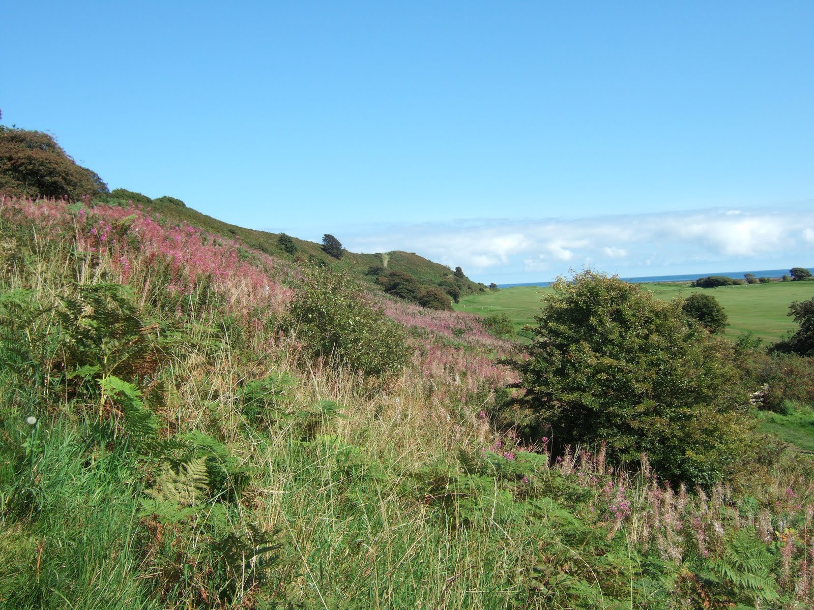
The sea and rocks were the twin stars of this walk. White horses flecked the sea for several hundred meters from the shore, ideal for surfing. Wetsuited young men were parking their 4WDs at the car park at Howdiemont Sands and running eagerly into the sea's embrace, boards at the ready. Despite a noticeable lack of bikinied girls to admire them, some managed a fairly tolerable impersonation of Beach Boys, standing up and riding the waves far out to sea.


Sea at high tide, Howick Haven


The geology on this part of the coast changes constantly. From Boulmer to Howick coarse-grained sandstone rocks jut out into the sea, forming 'steels' or reefs. These give protection for boats in Boulmer harbour. Further up the coast, steels give way to occasional outcrops of limestone and softer sandstone; so soft in fact that Earl Grey (who steered the 1832 Reform Act through parliament and had a particular taste in tea) had a man-made swimming pool gouged out of the rock next to his 'Bathing House' at Howick, just north of the Rumbling Kern bay. We all enjoyed the bay; climbing the rocks, watching the waves rush in and crash on the seaward side or just resting and watching the world go by.


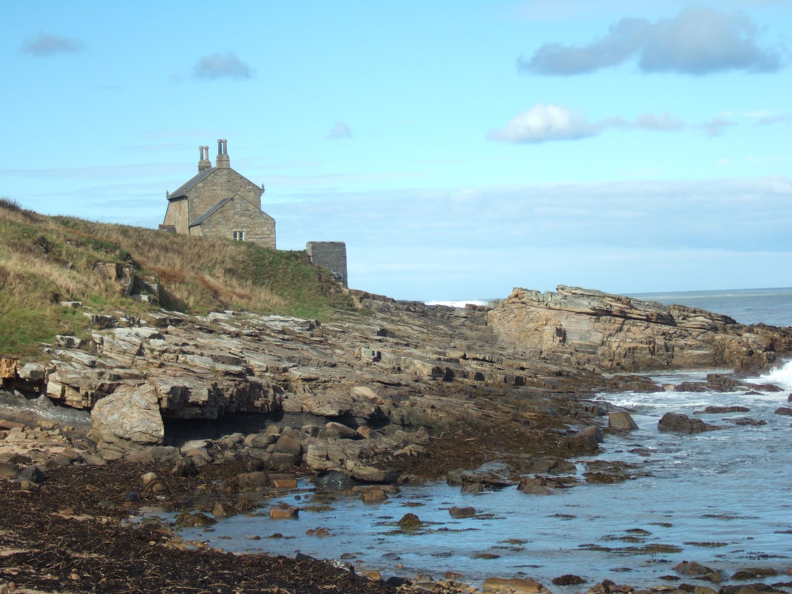
Earl Grey's bathing house, Howick


Just before reaching the bathing hut we came across Howick house mesolithic site, where from 2000 to 2002 an archaeological dig revealed a stone age structure dating 7600 years old - at that time the oldest house ever discovered in Britain. A reconstruction, at half the original size, has been constructed at the excavation site. It has a sunken floor with a central fireplace. The walls are held up with wooden stakes and turfed to keep out the cold and wind. It is estimated that the sea levels after the ice age rose by 50 meters, so this house was much further from the beach than today. I imagine their lives were nasty brutish and short, but they had a good view.


From Cullernose Point to Craster the rocks are of igneous (ie volcanic) whinstone. These form part of the Northumberland Whin Sill, whose outcrops of hard columnar basalt are to be found throughout Northumberland. The cliffs at Cullernose are the summer home of a big population of fulmars. They have flown the nest by September, leaving only guano-covered rock until the following spring. These sea cliffs are popular with climbers who like getting their feet wet!


Cullernose Point


The final section ends up in the garden of the Jolly Fisherman in Craster. More of this lovely village next time.


Friday 17 September 2010

Kielder capers


Kielder viaduct with skewed arches

We drove midweek up to Kielder castle and
village, intending to climb
Deadwater Hill behind the village. However disaster struck in the form of forgotten boots (mine!), and hill tracks in these border uplands being muddy, boggy and rocky we were obliged to lower our sights. A couple of tourist trails leading from the castle seemed more suitable for my Merrill sandals. First up was the Duchess Trail, so named because the 2nd Duchess of Northumberland liked to take her pony and trap over the pack-horse bridge at the back of the castle to amuse herself when the menfolk were away at the guns. (The castle is a former hunting lodge.)

The trail led down to the Kielder Burn. A wooden fence with observation holes gave on to another feeder, but it was the sight of a red squirrel that thrilled, scampering away before we could get out the camera.


Shortly after this the trail crossed the Duchess' humpbacked packhorse bridge, continuing on into the conifer plantations beyond before returning to the castle. These trees were planted in the 1930s from saplings brought from Aviemore in Scotland, to ensure our self-sufficiency in fuel in the event of another war. Kielder forest is the biggest man-made forest in Europe. Its conifers are often dark and sterile but this being september the forest was home to many fungi, including the beautiful but poisonous red and white fly agaric, the archetypal gnome home.


Fly agaric


After lunch we headed east to Bakethin reservoir, this time through broad-leaf woods of birch, beech, rowan, oak and hazel. The sunshine broke through the canopy and dappled the forest floor. We came upon Kielder viaduct, which took the trains of the Border County Railway across the North Tyne. The perspective of its 'skewed' arches, built at an angle to give a line of least resistance to the waters below, would challenge the artist. The path climbed up to the top of the structure, and we paused to admire the view of the castle and Deadwater Hill behind it. Closer to, a peacock butterfly enjoyed the warmth of the viaduct's lichen-covered sandstone blocks. The railway had been built to carry local iron ore and coal but its economic viability was always shaky and once these were mined out passenger and light freight were not sufficient to keep it open. The line closed in the 1950s. Nowadays a pedestrian trail runs the length of the old track along the North shore of Kielder Water.

Bakethin reservoir, a nature reserve, glimmered in the afternoon sun. It flows over a weir into Kielder water at its eastern end. Both reservoirs were the result of the flooding of the upper Tyne in 1982. A swathe of purple loosestrife stood by the water's edge and banks of bulrushes were visible on the south side of the water. Four cormorants preened themselves mid-lake, and two horses grazed the banks next to the trail, probably part of a targeted grazing programme to improve meadowland.

When I first visited Kielder, the surrounding hillsides had a raw, bare quality, with little variation of flowers and birds. Now nearly thirty years on continual improvement of the habitat has attracted greater diversity, including the return of the osprey and goshawk.


Peacock butterfly on the viaduct


Purple loosestrife next to Bakethin reservoir


'

Tuesday 7 September 2010

Once more on the way...

Well, the weather just gets better and better on St Oswald's Way, and beautiful blue sky followed us up the coast from Alnmouth to Boulmer. The path along the dunes between Alnmouth beach and golf course was lined with rose bay willow herb, in its prime in early september. No signs of trees turning colour yet, but their presence reminds us, just like the last night of the Proms, that summer is at an end.

Rose bay willow herb on the coast path


We pass the Old Battery. This grey squat stone building was used by the Percy Volunteers of Alnmouth village. Originally it had cannons facing out to sea, and the soldiers used it to practice firing them on targets in the sea. No sign of the cannons now, but it is well-preserved, with the plaque still visible: "(...) erected by Algernon, Duke of Northumberland KG (...)". I ponder the randomness of fashion in Christian names. When I read HG Wells and Oscar Wilde as a child there was inevitably a character called Algie. Now the name has disappeared, along with spats and bustles.


The path detours inland round Foxton Hall, a golf clubhouse, the beach just beyond here ending at the rocks of Seaton Point. The tide is going out, and near the caravan park at the point we see hirundines (house martins and swallows) massed on telegraph wires, a sign of their imminent migration, although on days like this they must think it's not really time to go!


House martins and swallows massed on the wires

Rounding the point, we walk by the side of Boulmer beach, and the tide reveals an enticing rocky shore which attracts many waders. We see (and hear) lots of oystercatchers, which are less black and white this time of year, some of them being juveniles and others moulting. At the pub in Boulmer we drink beer on a terrace overlooking the beach in the sunshine. How could life be better? Very close to us solitary redshanks, on disproportionately long legs, pick at marine life. It is time to return, and we walk all the way back on the beach, easily negotiable at low tide. A small flock of greenshanks, their beaks slightly upturned, feed on the tideline. I am excited by these birds of passage. They are stockier and larger than redshanks, and also rarer.

Greenshanks on Boulmer beach

Boulmer 'harbour' affords minimal protection for the small boats moored there as it is not hemmed in by land but by rocks, rather like a South Sea atoll. The rock-free entrance is so small it must be difficult to negotiate in stormy weather. There are two navigation posts on the shore just before the village. If a boat lines them up she will come through the gap in the rocks unscathed. I hope the volunteer lifeboat in Boulmer village is not used too much. Amongst these boats are two Northumbrian cobles, small inshore fishing boats with canvas covers, one brick red, the other white, at the bow.
Cobles in the bay at Boulmer
Back on Alnmouth north beach, Peter dons a pair of swimming trunks and takes his first (and probably last) swim in the North Sea this year. He emerges with a bleeding leg, a hidden underwater rock having gashed his shin. He declares the water is warm, but I
am not tempted, preferring to watch the terns doing their straight dive into the water out to sea.